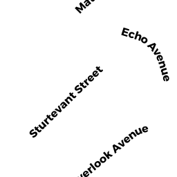
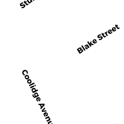
12 BLAKE ST
Owner Information
ROOP CHARLES A
12 BLAKE ST
BEVERLY, MA 01915


Property Details
12 BLAKE ST is classified as a Single Family Residential (Rr/splent).
The primary structure on this property was built in 1960. There are 1,600ft2 of built area within this property. There is 1,600ft2 of residential/living space within this property. This property is listed as having 6 rooms.
12 BLAKE ST is valued at $538,000. The land is valued at $261,500 and the structures are valued at $275,800. There is an additional valuation of $700 on this property.
This property is in Zone R10. Confirm with local Zoning Board authorities to ensure there are no overlays or other easements on this property.
The most recent deed for 12 BLAKE ST is recorded at the local registrar in Book 31586, Page 513. 12 BLAKE ST was last sold on Friday, August 3, 2012 for $382,000.
Assessment data from fiscal year 2022.
Flood Data
According to the FEMA National Flood Hazard Layer, this property does not appear to be in a flood zone. It may also be in an area not yet reviewed. Nonetheless, confirm this information prior to taking any action.
To view the flood hazards around this property, create a FEMA "Firmette" Map of the area around 12 BLAKE ST.
Broadband Internet Providers
| Provider | Type | Bandwidth (mbps) | |
|---|---|---|---|
| Crown Castle Fiber | Fiber | 0 | 0 |
| T-Mobile | Fixed Wireless | 25 | 3 |
| Comcast | Cable | 1000 | 35 |
| VSAT Systems, LLC. | Satellite | 2 | 1 |
| Verizon New England Inc. | DSL | 10 | 1 |
| Viasat Inc | Satellite | 100 | 3 |
| GCI Communication Corp. | Satellite | 0 | 0 |
| HughesNet | Satellite | 25 | 3 |
Broadband service provider data from December 2020.
Adjacent Properties
- 3 COOLIDGE AVE
Single Family Residential owned by HURLEY KEVIN D - 8 COOLIDGE AVE
Residential Condominium owned by GRIFFIN DAVID E JR - 10 COOLIDGE AVE
Residential Condominium owned by MCCARTHY ALEX - 10 BLAKE ST
Single Family Residential owned by BATES MICHEL A - 245 ELLIOTT ST
Apartments with More than Eight Units owned by FAIRWEATHER PRESERV ASSOC LMTD - 55 PEARSON ST
Three-Family Residential owned by 55 PEARSON BEVERLY LLC